From Kibbutz to the global stage
Baptism 2030: Did John the Baptist Move North to Tel Shalem near Beit She’an?
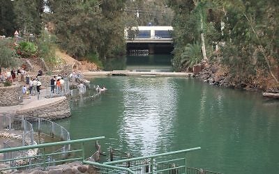
Could a rising Dead Sea have led John from the lower Jordan to the springs of Aenon near Salim?
The Copper Scroll’s reference to the second tithe may preserve a record from when the Second Temple still stood, offering a clue to the scroll’s date.
Living Water and a Rising Dead Sea
Did fluctuations in the Dead Sea’s level in the first century CE influence where John the Baptist baptized? And what can the Copper Scroll tell us about water infrastructure in the Jordan Valley on the eve of the Second Temple’s destruction?
For generations, scholars have studied the origins of Christianity and the Copper Scroll (3Q15) along separate lines. New Testament scholars have examined the Gospel accounts of baptism and the traditions of pilgrimage, while scholars of the scroll have sought to understand what was deposited at the places it lists. I propose starting with the landscape. We can examine the Dead Sea’s levels, the slope of the terrain, and the available sources of water, then compare what we find with the written sources.
The Gospel of John’s account of John the Baptist, the reference to the second tithe at Kahlat, and the final four entries of the Copper Scroll suggest a hypothesis we can test. If the rising Dead Sea flooded parts of the lower Jordan or made local water sources more saline, springs farther north may have become more important. We can test this hypothesis even at lake levels of 380 to 370 meters below sea level. Identifying the water installations described in the Kahlat entries could also help establish when they were used and when the associated entries were written.
1. How high was the Dead Sea in the first century?
Any attempt to reconstruct John’s movements begins with the question of how high the Dead Sea stood during his lifetime. Two sets of reconstructions give us very different pictures of its northern shore.
Zipora Klein’s reconstruction of a sharp rise. A reconstruction included in a 1998 regional water-resources review prepared with assistance from the US Geological Survey (USGS) shows an estimated peak of about 330 meters below sea level toward the end of the first century BCE, followed by a steep decline (Zipora Klein’s curve in the 1998 regional water-resources review, also reproduced in my Times of Israel article on the Qumran caves and baptism sites). The question here is where the lake stood in the decades that followed, when John was active.
Late Holocene reconstructions. In 2004, Revital Bookman and her colleagues published a reconstruction based on sediments, shoreline indicators, and radiocarbon dates. It places the lake between roughly 390 and 415 meters below sea level over the late Holocene (Bookman et al., Late Holocene Lake Levels of the Dead Sea, 2004). Claudia Migowski and her colleagues provided another set of data for comparison in their study of sediment cores (Migowski et al., 2006). The anchorages at Rujm al-Bahr and Khirbet Mazin also serve as indicators for reconstructing lake levels in the late Hellenistic and early Roman periods (Dead Sea Levels during the Bronze and Iron Ages, discussion of the ancient anchorages). To assess what they can tell us about John’s time, we need to distinguish when the anchorages were built, when they were used, and when the shoreline sediments were deposited.
The gap I want to investigate concerns the opening decades of the first century CE. Do the shoreline ridges or the sediments at the Jordan’s mouth contain samples whose dates could narrow the uncertainty to the years of John’s activity? Where lake levels for those years are inferred from the elevation of the anchorages, we need to ask whether independent evidence establishes when those anchorages were in use. Because the plain at the river mouth slopes so gently, I propose testing lake levels of 380 and 370 meters below sea level. For each scenario, we can map the extent of inundation, estimate how far north saline water could have reached along the river channel, and assess the effects on shallow groundwater and access to the riverbank.
Mohammad Waheeb documents fieldwork at Al-Maghtas between 1996 and 2002 (Mohammad Waheeb, Annals of the Department of Antiquities of Jordan, vol. 49, 2005, pp. 345–349). As part of an investigation into salinity, it would be worth tracing the documentation for a reported observation that excavation pits at Tell al-Kharrar filled with saline water. Where at the site did this occur, at what depth, and under what conditions? If confirmed, the observation would help establish how susceptible the site is to saline groundwater intrusion. Connecting such intrusion to John’s time would require dated evidence from the period itself.
2. John’s route from Bethany Beyond the Jordan to Aenon
The Gospel of John describes two places where John baptized, each with its own water sources and conditions of access.
The southern site, Bethany Beyond the Jordan. John 1:28 names “Bethany,” while some textual traditions read “Bethabara.” The traditional identification points to the area of Al-Maghtas and Qasr al-Yahud. Al-Maghtas is inscribed as a World Heritage Site (UNESCO, Baptism Site “Bethany Beyond the Jordan” (Al-Maghtas), site no. 1446). Within Al-Maghtas, Tell al-Kharrar and the low-lying baptism area by the river are distinct locations. I previously proposed identifying the tell with the Copper Scroll’s Kahlat (Rafi Glick, “Baptism 2030: Is the Copper Scroll’s Kahlat at Bethany Beyond the Jordan?”, The Times of Israel). The aqueducts and cisterns, along with a possible embankment that served as a landing place under my proposed reading of the notation XAG, can all be investigated in the field. The identification of Kahlat and the precise location of the baptism are separate questions.
The northern site, Aenon near Salim. The Gospel gives an explicit reason for choosing this place, “because there was plenty of water there” (John 1:28 and 3:23). The account establishes that John was active at another site. It leaves open when he moved there, how long he stayed, and whether he ceased baptizing along the lower Jordan.
Two proposed locations for Aenon are worth comparing.
Tel Shalem and Ein ed-Deir, south of Beit She’an. Eusebius of Caesarea placed Aenon about eight Roman miles south of Scythopolis (Encyclopedia of the Bible, “Aenon”). This tradition points to Tel Shalem and its springs and provides a basis for examining John’s connection to the Jordan Valley route. Shimon Gibson’s book provides archaeological context for the discussion of John’s movements (Shimon Gibson, The Cave of John the Baptist).
Salem and Einun, east of Nablus. Another proposal identifies Salim with Salem and places Aenon near Einun and the springs of Nahal Tirza, also known as Wadi al-Far’a (The Catholic Encyclopedia, “Ænon”). Chapter 4 of the Gospel describes Jesus passing through Samaria and reaching Jacob’s Well near Mount Gerizim (John 4:3–26). Samaria thus figures in the adjoining chapters of the Gospel. Locating John’s baptism site there would require evidence specific to his activity.
Flooding and increased salinity offer a possible explanation under either identification. If the lower Jordan became more saline or its banks became harder to reach, springs independent of the lake level would have offered a practical alternative. Josephus describes John’s baptism in connection with purification of the body (Josephus, Antiquities of the Jews 18.116–119). The Mishnah distinguishes among different uses of seawater for ritual purification (Mishnah Mikva’ot 5:4). I therefore propose examining salinity, mud, and access as practical conditions for baptism and treating the applicability of the laws governing “living water” as a separate question.
3. Mount Gerizim, Nahal Tirza, and the spring of Beit Shem
In my work on Kahlat and Ramat Rachel, I have proposed reading some of the Copper Scroll’s descriptions in light of known or possible water installations. The four entries that close Column XII, numbered 57–60 here, allow us to extend the inquiry northward. Do the places they name form a single route from Mount Gerizim through Nahal Tirza to the Jordan Valley?
Entry 57, Mount Gerizim. The entry explicitly names the mountain and refers to ha-shit ha-elyona. Under my proposed reading, we can look for a water installation near the mountain whose location, elevation, and relation to access routes fit the description. We can also examine whether it was connected to the springs of the Shechem valley.
Entry 58, “at the mouth of the spring of Beit Shem.” The spring gives us a geographical point of reference. One possibility is a connection with Beit She’an and Tel Shalem, allowing for a change in the ending of the place-name. Another is a connection with Shechem and Salem, suggested in part by the entry’s proximity in the scroll to the one naming Mount Gerizim. Either identification would require linguistic parallels for the name “Beit Shem” and evidence of a spring that fits the description.
Entry 59, “the great conduit.” My working hypothesis is that the entry describes an installation that conveyed or drained water in the Nahal Tirza basin. The entry includes the word “weight” and gives a quantity in talents and minas. Interpreting that figure as hydrological data would require a sound basis for relating the units in the entry to volume and time. Identifying a physical installation would allow us to estimate its capacity from its cross-section, gradient, and water level.
Entry 60, “north of Kahlat.” The final entry mentions a copy of the document and its explanation (Copper Scroll, Column XII, The Dead Sea Scrolls Study Edition, Brill, 1999, pp. 237–239). The directions may refer to the northern side of the site of Kahlat. If the name also covered a wider area, we could investigate a connection with the mouth of Nahal Tirza near the Adam Bridge at Damia and test the possibility that the entry points to a more detailed copy of the records.
How much water flows through Nahal Tirza?
One study puts the area of the Nahal Tirza basin at about 320 square kilometers (A Preliminary Investigation of Wadi–Aquifer Interaction in the Semi-Arid Watershed of Faria, Palestine, Using Tracer-Based Methodology). Its flow comes from springs and from pulses of seasonal runoff. Basin surveys provide discharge data that we could compare with the capacity of an installation, should one be found (JICA report, section 3.3). The comparison would need to distinguish among total annual water volume, ordinary spring discharge, and peak flood discharge. It could help establish what the installation was used for and whether it fits the description of the “great conduit.”
4. Mount Gerizim and the dating of the Copper Scroll
Scholars including Ben-Zion Luria and, in later work, Joan Taylor have explored a possible connection between the Copper Scroll and the Bar Kokhba revolt of 132–135/136 CE (The Copper Scroll: The Medium, the Context and the Archaeology). Mount Gerizim offers a way to test that proposal against the changes that took place around Shechem between the two revolts.
In the late Second Temple period. The ancient Samaritan temple had already been destroyed in the wake of John Hyrcanus’s campaign at the end of the second century BCE. The mountain remained sacred to the Samaritans. Josephus describes a Samaritan gathering and a confrontation with Vespasian’s forces on the mountain in 67 CE. Identifying the installation mentioned in the scroll would allow us to investigate whether it was in use in that setting in the first century.
At the time of Bar Kokhba. By then, Flavia Neapolis, founded after the First Jewish Revolt, stood at the foot of the mountain. The Roman temple of Zeus is attested in the second century, and the evidence for its existence under Antoninus Pius postdates the Bar Kokhba revolt (Roman Altar on Mount Gerizim: Rediscovering a Civic Icon on Tetradrachms of Neapolis, Samaria, Journal of Roman Archaeology). The chronological test is when the specific installation was in use and whether it could have been accessed in either period.
5. The second tithe, Herodian infrastructure, and a date around 70 CE
In Column I, lines 9–12, the entry for Tel Kahlat mentions vessels associated with demai, the “second tithe,” and an opening at the edge of the aqueduct. Vessels associated with demai are also mentioned in Columns XI and XII (Copper Scroll, Columns I, XI, and XII, The Dead Sea Scrolls Study Edition, Brill, 1999). The combination may point to procedures for storing, recording, or handling property associated with tithes. I propose examining three possible links between the entry and the late Second Temple period.
Jewish law and the administration of tithes. The second tithe was to be eaten in Jerusalem or redeemed for money to be spent there (Deuteronomy 14:22–26). According to Maimonides, the obligation to set aside the second tithe continued after the Temple’s destruction, while eating it in Jerusalem depended on the Temple still standing (Maimonides, Mishneh Torah, Laws of the Second Tithe and Fourth-Year Produce, chapter 2). If the Kahlat entry records the routine administration of a tithe intended for use in Jerusalem, that would support dating the underlying record to the Temple period. The entry might also reflect the handling of consecrated property following the destruction or the later copying of an earlier record (for proposed post-destruction dates, see The Copper Scroll: The Medium, the Context and the Archaeology). We therefore need to distinguish the date of the activity recorded, the compilation of the entries, the engraving of the scroll, and its deposition in Cave 3. The years 68–70 CE offer a possible window for compiling the entries or depositing the scroll during the First Jewish Revolt.
How long the Herodian infrastructure remained in use. Under my proposed identifications, some of the pools, aqueducts, and structures mentioned in the scroll may belong to the building programs of Herod and his successors at Jericho and around Jerusalem. If a facility matching a particular entry is found, we can ask when it was built, what repairs it underwent, and when it went out of use. Its period of use could help us determine whether the entry describes an installation operating around the time of the Temple’s destruction or a place that remained known in later generations.
Tell al-Kharrar and a possible water route to Qumran. Researchers cite a late nineteenth-century travelers’ account of two oil lamps and three coins attributed to the time of Agrippa, reportedly found in a burial cave near the southern slope of the tell (Mohammad Waheeb, Asian Social Science, 2012). The account offers a possible clue to an early Roman presence. Its value for dating the installations on the tell depends on verifying the finds and their archaeological context. If a reconstruction of the shoreline during the First Jewish Revolt shows that the water reached a point accessible from the proposed landing place, we can examine whether a copy of the scroll might have been taken by boat to the Qumran area while a more detailed copy remained “north of Kahlat.” That scenario depends on identifying and dating the landing place and reconstructing a navigable route for those years.
Fieldwork at the Jordan’s mouth and at Tel Shalem
Two field investigations could advance the questions raised by the Gospel and the scroll.
Reconstructing the lower Jordan in the first century. Sampling shoreline sediments, alluvial terraces, and channel fills on both banks of the Jordan, then dating them where appropriate by radiocarbon or optically stimulated luminescence (OSL), could help map the extent of inundation. Combining the results with a reconstruction of the ancient channel and a search for signs of salinization would help assess the impact on the riverbank and the springs at Tell al-Kharrar.
Survey, conservation, and development at Tel Shalem and Ein ed-Deir. The tradition placing Aenon south of Beit She’an warrants a survey of the springs, access routes, and early Roman remains west of Highway 90. Comparing the findings with the area around Salem and Nahal Tirza would allow both proposed locations to be tested. In the lead-up to “Baptism 2030,” Tel Shalem could be included in a research and conservation program that presents the tradition and the survey findings to the public.
In the south, evidence dating flooding or salinization to the years of John’s activity would strengthen the case that water conditions influenced his choice of baptism site. At Tell al-Kharrar, identifying and dating an installation that matches the Kahlat entry would help test whether the reference to the second tithe reflects routine administration while the Temple stood or the handling of property after its destruction.
Related Topics