Ancient and Unique Uzbekistan: Surkhandarya Region I
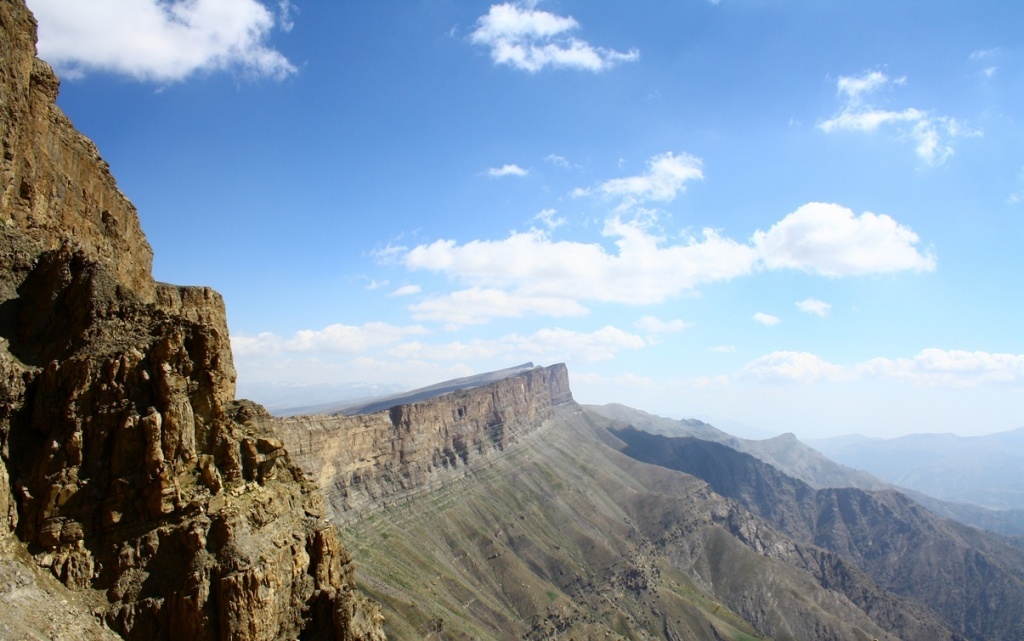
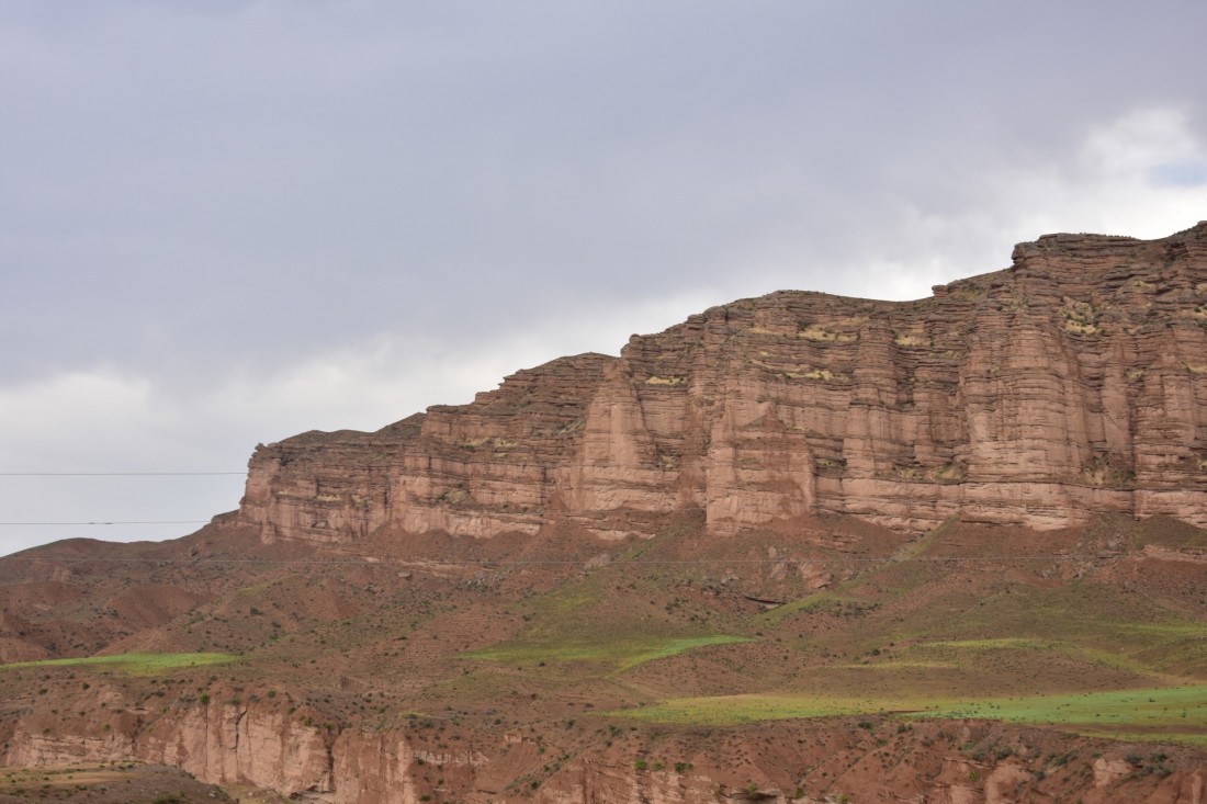
The Surkhandarya region is the cradle of ancient civilizations. In the region, you can see the incredible beauty of the natural landscape: caves, massifs, gorges. These places attract a lot of attention from travelers and adventure seekers.
Here you can get acquainted with the monuments of the distant past, including open-air museums, Buddhist temples, the ruins of ancient settlements and fortresses, as well as places of worship.
Surkhandarya region is the southernmost region of Uzbekistan. It occupies the Hissar Range in the north, the Babatag in the east, the Kugitangtau and Baysuntau spurs in the west, and the Amu Darya in the south.
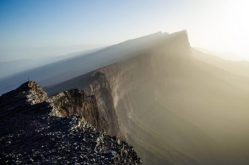
Nature continues to amaze with its incredible beauty. Sometimes it creates the most amazing corners on the planet, and such a corner is the Surkhan reserve, located in the southwestern spurs of the Hissar range of the Pamir-Alay Mountain system.
The Surkhan Nature Reserve is a protected natural area. Its area is over 24 thousand hectares. Rare and endangered species of flora and fauna live here. Among the representatives of the fauna, there are animals that are on the verge of complete extinction: the markhor and the urial. Among those listed in the Red Book, such venerable cats as the leopard and the Turkestan lynx live on the territory of the reserve, as well as striped hyenas, gazelles, white and black storks, black vultures, bearded vultures, snake-eaters, and other animals. Among those listed in the Red Book, such representatives of the feline family as the leopard and the Turkestan lynx live on the territory of the reserve, as well as striped hyenas, gazelles, white and black storks, bearded vultures, short-toed eagles, and other animals.
Some plant species are very rare and grow only in the mountains of the southern part of Uzbekistan.
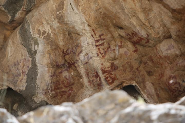
On the territory of the reserve, you can see the most important archaeological monuments, the discovery of which has become a great historical event. Among them are unique rock paintings of the Meso-Neolithic period, showing scenes of ancient people hunting for a bull and a wild goat in the Zaraut-Kamare cave. Surprisingly, the images did not lose their brightness, and their paint did not fade. The composition of the paint remains a big mystery to scientists to this day, but the most important discovery was the remains of a Neanderthal teenager found in the Teshik-Tash cave. The discovery was made in 1938 by the archaeologist A.P. Okladnikov. He discovered the burial of a child surrounded by the horns of mountain goats dug into the ground. Such a burial testifies to the existence of logical thinking and the presence of cultural cults among the Neanderthals.
In addition to important archaeological sites, there is a unique Aral-Paygambar Island on the territory of the reserve, located on the Amu Darya River. This island is a holy place for pilgrims, as one of the 25 Muslim prophets, Zul-Kifl is buried here. A mausoleum was built over his grave, and the place is sacred.
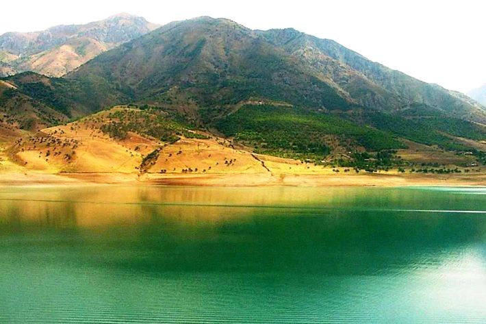
There are 5 reservoirs on the territory of the Surkhandarya region, one of which is the Topalang reservoir. Its construction began in 1982 in the Sariosiyo district. Today the height of the dam is 122 meters and it is one of the most attractive places in the Surkhandarya oasis, rich in natural diversity. The main water source of the reservoir is the Topalang River, which is formed by a tributary of the Karatag and Topalang rivers flowing from the southern mountain ranges of the Hissar and is the right tributary of the Amu Darya. Topalang translated from Tajik means “Red River”. The river is 175 km long, the basin area is 13,500 km. From June to August, the river floods.
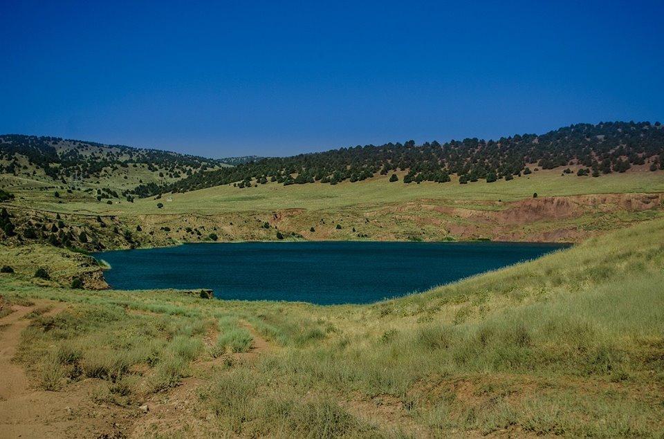
In the Khamkan tract in the Surkhandarya region, there is a small lake Kanbeshbulak. It is interesting because some scientists consider it a meteorite crater. According to one version, the lake appeared after a meteorite fell. As a result, a crater was formed here, which was then filled with water. In the soil and in the river sand leading to the lake, numerous fragments and vitreous bodies have been found that are of cosmic origin. Lake Kanbeshbulak and the surrounding area have not yet been sufficiently explored and, perhaps, still hide many mysteries. The reservoir can become one of the natural monuments that attract lovers of the unknown and mysterious.
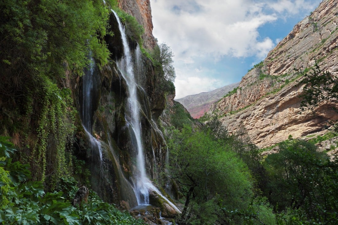
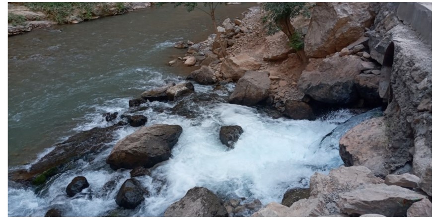
The Sangardak waterfall is located 205 kilometers from the city of Termez, on the territory of the Sariosiyo district. Sangardak can rightfully be called one of the most beautiful places in Uzbekistan.
The water falling from a height breaks into billions of microscopic sprays that rise into the air and create a light fog on the surface of the rocks. The rocks surrounding the waterfall are covered with green moss. According to the local tradition, if you tie a small piece of fabric on the territory of Sangardak, making a wish, it will certainly come true.
A real treasure for lovers of archeology can be called the Teshik Tash grotto cave, which is located in the Baysuntau mountains and is known for the location of the Mousterian culture and the burial of a Neanderthal boy found here.
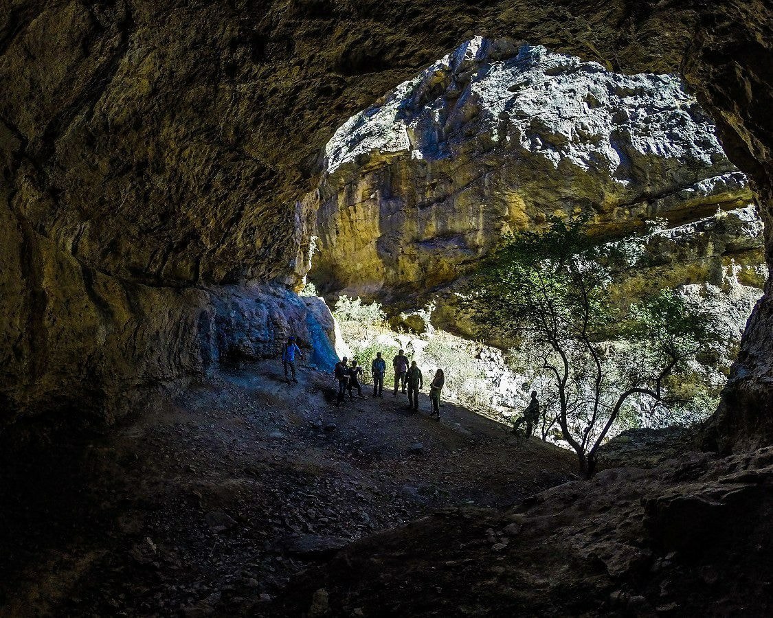
Another cave, Khojaypok, is located at the foot of Mount Kenagi. The depth of the cave has not been fully studied by specialists.
In Uzbekistan, they believe that nature works miracles and heals. The healing spring water that flows from the surface of the Hojaypok cave is 45 meters long and flows into a small underground river. About 200 liters of water come out of the cave per second.
The composition of the water was studied by the laboratory of the Simashko Research Center. It has been found to contain sodium, potassium, calcium, sodium bicarbonate, silicic acid, nitrogen, iron, aluminum, and other trace elements. The Hojaypok Health Center is also located nearby.
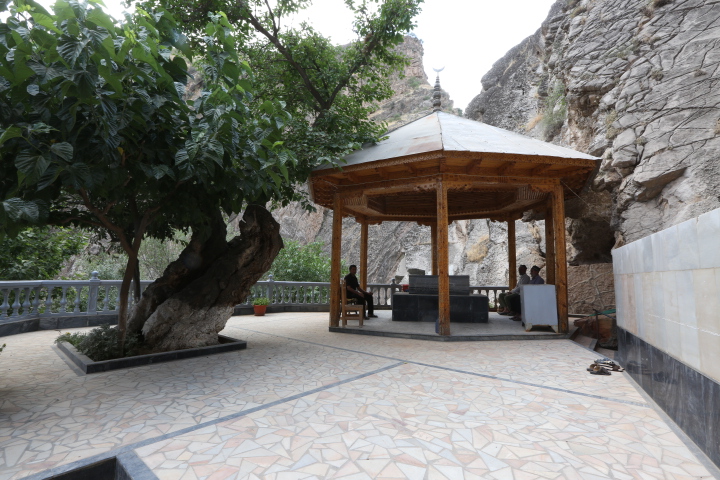
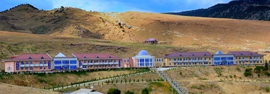
To the east of the center of the Boysun district, a sign on the side of the main road will lead you to the Omonkhona sanatorium. The sanatorium is located in the village of Omonkhona. According to local elders, people have lived here for 700 years. This is evidenced by the old cemetery in the village and the gravestones on it. The word “Omon” means healthy, safe, peaceful, serene, and the word “khona” means room, place, space. Thus, Omonkhona is a place of peace, health, and tranquility. Turning off the main road, you reach the center of the village, walking 15 kilometers over the hills.
It is believed that the water flowing from the source of the Omonkhona cave sanctuary has healing properties and cures diseases of the gastrointestinal tract. There are many stories and legends associated with this place. Local residents claim that within 10 days of treatment, the patient’s condition improves, the pain disappears, the liver contracts, and enzymes decrease. And also, sugar is reduced and the intestines are cleansed. In the summer season, people come here to relax and improve their health not only from all over the republic but also from neighboring countries. And this inflow is increasing every year.
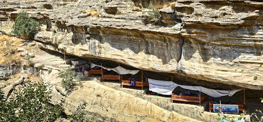
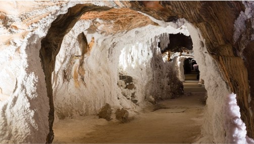
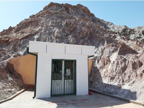
The Khojaykon salt cave is located in the Sherabad region, and for several years now the services of sanatorium-resort treatment have been provided here. One of the services is a treatment in a salt cave called speleotherapy.
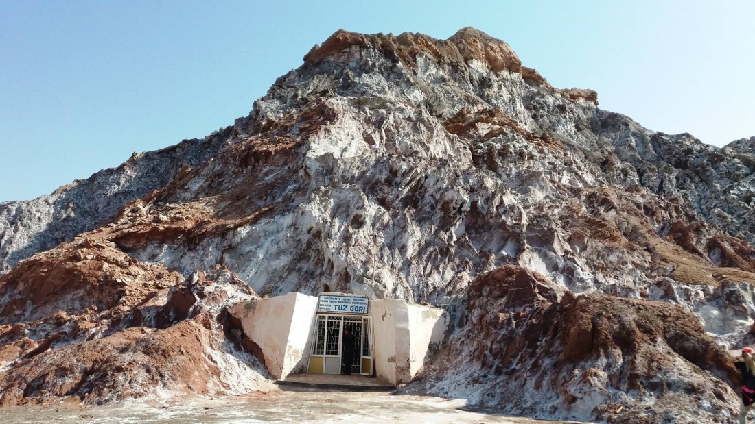
The Khojaikon salt cave was found in 1989. Staying in such a cave is very useful for patients with asthma, chronic bronchitis, complications of pneumonia, as well as skin diseases, and reduced immunity.
The advantage of this salt cave over other caves of this type is that the climate here is dry and it is located at an altitude of 1200 meters above sea level.
The Khojaykon salt cave is 155 meters long; inside it, there are 3 treatment rooms, which differ from each other in temperature, humidity, pressure, and microelements.
The Khoja Gur Gur Ota massif is one of the striking sights of the Boysun Mountains.
This is an unusual giant peak with a 500-meter cliff on one side, and deep canyons on the other. “Father of all caves” – this is how the Khoja Gur Gur Ota Mountain range is called.
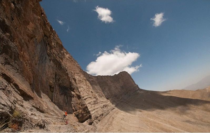
The caves in the area are some of the deepest in the world, but the difficulties do not end there. In fact, in Khoja-Gur-Gur-Ata, the entrances to the caves are located in the rock at different heights, and the voids are cut by tectonic processes and erosion. The entrances to the caves open at an altitude of 3.200 to 3.800 m above sea level.
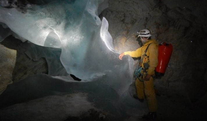
This place attracts not only climbers but lovers of extreme. There is also an ancient shrine and a gorge with a holy spring called Khuzhamaikhona. Khuzhamaikhona is a natural source of spring water rich in minerals.
Three cubic meters of water splashes out from the source. The water is clear and cold from winter to summer. In the spring there are fish here, but no one catches them. The largest fish seen in the spring was up to 1 meter long. The depth of the cave next to the source has not been studied, since the water in it freezes, which complicates the already difficult task since the entrance to the cave is very narrow.
An even more ancient find of this region is the Zarautsoy petroglyphs – the oldest rock carvings located in the southwest of the Hissar range, on the eastern slopes of Mount Kohitang in the Sherabad district, in the Zarautsoy gorge. More than 200 images of red engobe were found in 1912. Zarautsoy’s drawings depict people hunting wild bulls with dogs. Animals such as a wild bull, a dog, a fox, a wild boar, a goat with markhor, a gazelle, a mountain goat, insects are depicted in a unique way, as well as various objects – bows, spears, sickles – and people in masks.
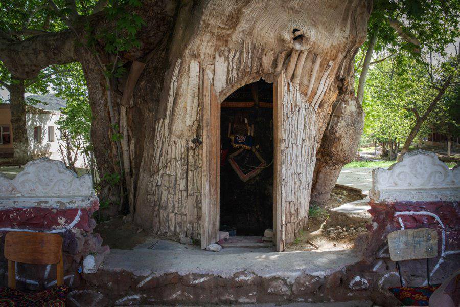
The famous Syrob plane tree is perhaps the most venerable tree in the region, dating back a thousand years. The trunk of the tree is empty, and the hollow formed in it is so large that there used to be a small school inside, which could accommodate twenty students with a teacher. Now there is a mini-museum inside. The plane tree is protected as a natural monument and is a local shrine.
In Termez, the most ancient city and center of the region, a number of monuments of architecture and archeology, ruins of settlements and fortresses of various peoples, such as Zoroastrians, Nestorians, Buddhists, and, of course, monuments of Islamic architecture, have been preserved.
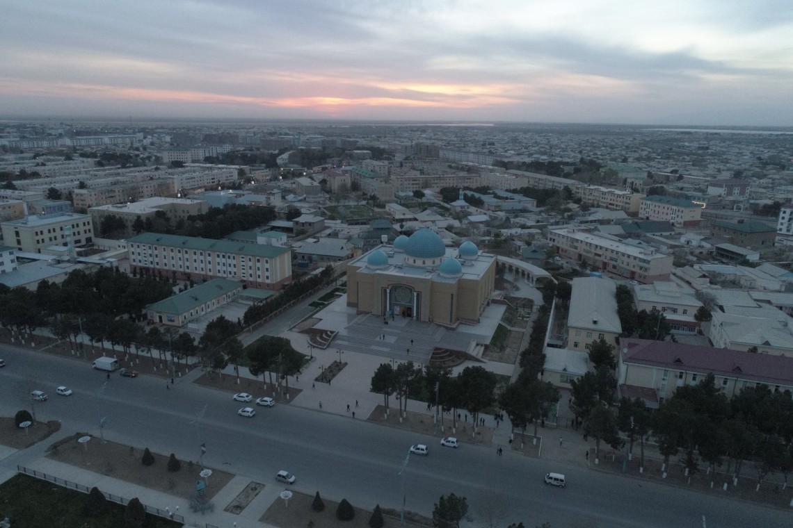
According to archaeologists, the city was created as early as 1 millennium BC, making it one of the most ancient cities in the entire world.
The name “Termez” comes from Sanskrit “taramato”, which translates as “on the riverbank” and it received its final name only in the 10th century. Prior to this, the city changed many names, such as Demetrius, Tamo, Tami, etc. It is believed that Buddhism came to the territory of Termez during the time of the Greco-Bactrian kingdom. This is confirmed by many archaeological finds dating back to that era. You can still find Buddhist buildings in the city and its surroundings, and in museums, there are many items related to this ancient religion.
Over the millennia of existence, the city was ruled by many dynasties, among which were the Achaemenids, Alexander the Great, the Kushan kingdom, and many others.
During the time of Amir Timur and his descendants, Termez occupied a special place in the ambassadorial relations with China.
The southernmost region of Uzbekistan, Surkhandarya, has been attracting many archaeologists and tourists from all over the world for more than half a century. And this is not casual. The most ancient city of Termez, which not so long ago celebrated its 2700th anniversary, is surrounded by ancient historical monuments, including the settlements of Fayaztepa, Kampyrtepa, Dalverzintepa, Karatepa, and Ayritam.
In 1968, a statue of Buddha was discovered on the territory of Old Termez. Since then, this land has become the main object for study by many scientists and archaeologists, due to which later the most ancient Buddhist temple complexes were discovered: Fayaztepa (1st century BC – 3rd century AD), Kampyrtepa, Karatepa. And the discovery of elements of the famous Ayrtam frieze depicting ancient musicians became evidence that Buddhism was once preached on the territory of this region and elements of Hellenistic culture were revealed. Now the terracotta bas-reliefs of the frieze are kept in the State Hermitage Museum in St. Petersburg.
The territory of Surkhandarya is unique and mysterious. Here, in the very heart of Central Asia, Buddhist monuments and ancient settlements have been preserved. According to experts, Buddhism as a religion spread in Termez at the time when missionaries from Gandhara in Northwest India began to arrive on its territory.
In 1968-1976, one of the largest specialists in archeology and art history of Uzbekistan and Central Asia, Lazar Albaum, was studying the Fayaztepа monument.
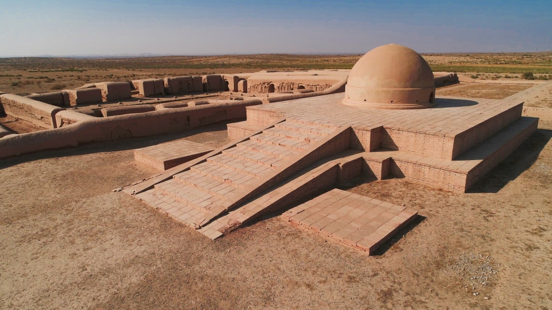
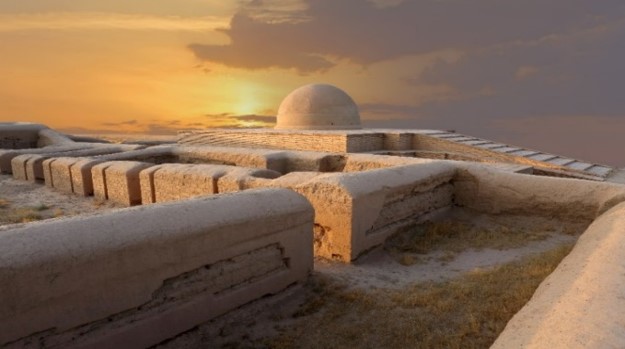
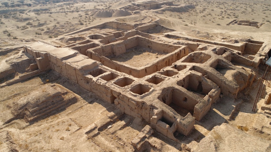
One of these monuments is the Fayaztepa temple complex, dating back to the 1st century BC – III century AD. The complex is located on the territory of the ancient city of Termez, between the banks of the Amu Darya and the ancient caravan route. Since the 9th century, the complex has been destroyed and eventually disappeared into the sand dunes.
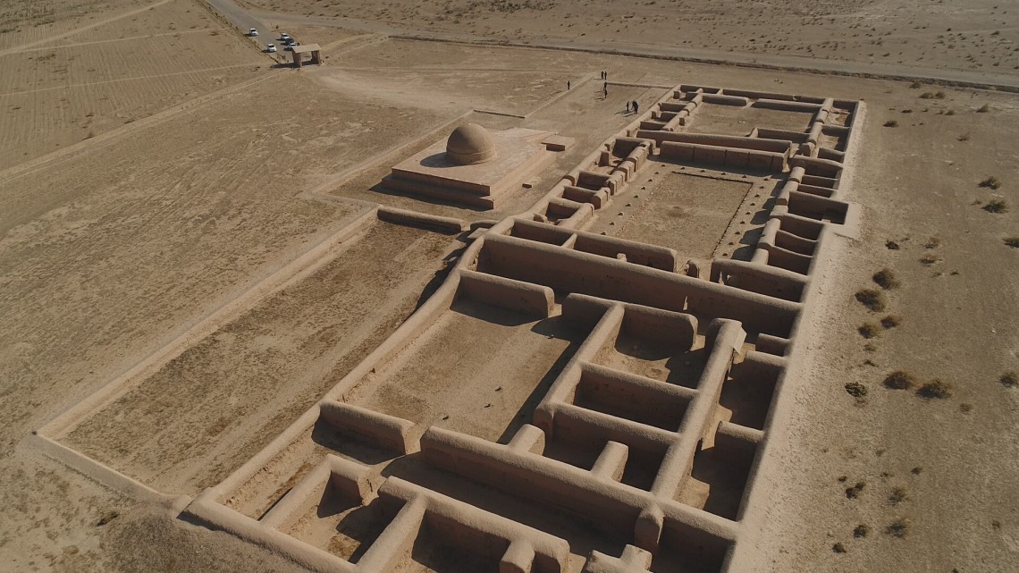
Fayaztepa Monastery, 34 m wide and 117 m long, was built from northwest to southeast and consists of 3 parts. Its central part, the temple, is located in a square-shaped courtyard with a veranda and is surrounded by monastic cells and utility rooms.
A few meters northeast of the main building of Fayaztepa, there is a stupa with a perfectly round dome and a cruciform foundation. Its dome was decorated with red lotus flowers. Here ritual ablutions were performed.
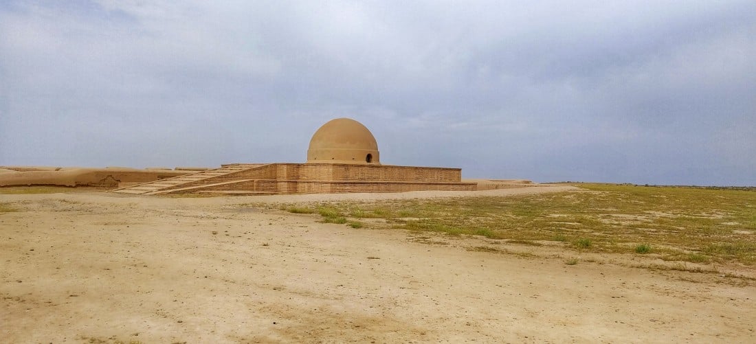
This stupa was built in the 1st century BC. The very word “stupa” in translation from Sanskrit means “the embodiment of the cosmos”.
Subsequently, an even larger stupa was built on top of this stupa. On its square base, several meters high, a cylindrical structure was built. Its height reaches approximately 10 m. The stupa is crowned with a domed roof with “umbrellas” made of stone. Such umbrellas are called “chatra” in Buddhism. Chatra was considered a symbol of a sacred tree, in the shadow of which Buddha reflected on the theoretical foundations of his religion.
The discovery of a white stone statue in Fayaztepa in 1972 is very important. The statue depicts Buddha and two monks. Buddha sits under the sacred Bodhi tree and the monks stand on either side of it.
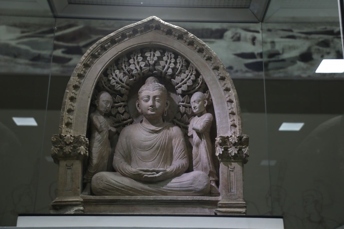
There was a courtyard in the central part of the temple. He gave the building elegance and originality because the walls of this courtyard were complemented by columns and relief paintings. In the middle of the courtyard, a Triad was found, which depicts the Buddha sitting under the sacred bodhi tree in a pose of tranquility and spiritual harmony. The whole composition is a symbol of divinity, peace, and tranquility. The found Triad is a most valuable find and it is kept in the State Museum of the History of Uzbekistan, and a copy of it can be seen in the Termez Archaeological Museum.
Other ancient artifacts were found on the territory of the complex, namely a clay Buddha statue, coins, dishes, as well as various household items, and lamps with images of a lotus.
The Fayaztepa Temple was named after R.F. Fayazov, who was the director of the local museum and made great efforts in the study of this architectural monument. The complex is a Buddhist artistic heritage in Uzbekistan and is known all over the world.
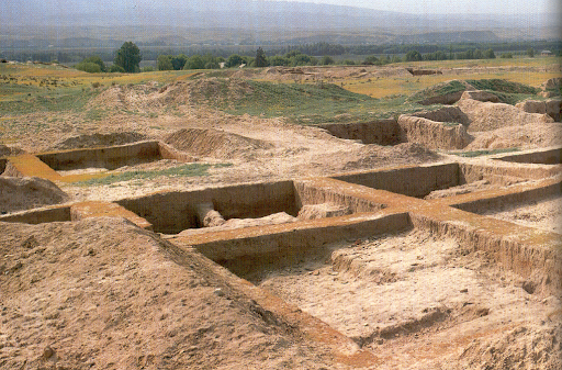
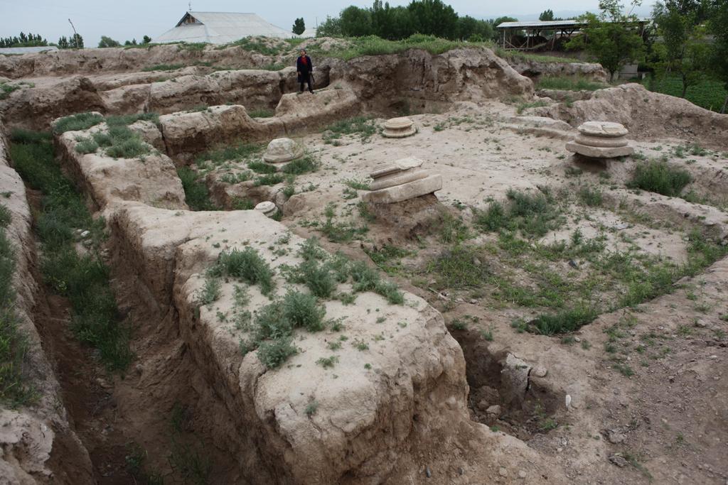
Dalverzintepa is the residence of the Kushan kings. Among the monuments of the era of the Kushan Empire of the 1st-4th centuries AD, the ancient settlement of Dalverzintepa, which is located in the Shurchinsky district of the Surkhandarya region, 60 km from Termez, occupies a special place.
A more detailed study of this place began in 1967 by historians Galina Pugachenkova and M.E. Masson. In the northern part of the ancient city, a temple of the Bactrian goddess and unique paintings were discovered. On the territory of the settlement were found the ruins of a Buddhist temple, founded at the beginning of the 1st century AD. This is the oldest Buddhist building in Uzbekistan. During the era of the Kushan Empire, cities, districts, and residential areas flourished here.
In 1972, when studying the ancient quarters of the settlement, a treasure of gold items weighing 36 kg was discovered in one of the alleged houses. In terms of its scientific significance, the Dalverzin treasure is not inferior to the famous Amu Darya treasure, which is kept in the British Museum.
Recently, an exhibition of items from the collection of the famous Dalverzin treasure was held in Tashkent.
During the excavations at the site, various ivory items were found, a special place is occupied by the world’s oldest chess pieces of the 1-2 centuries AD, items made of precious stones, coins, and exquisite ceramics dating back to the Greco-Bactrian era.
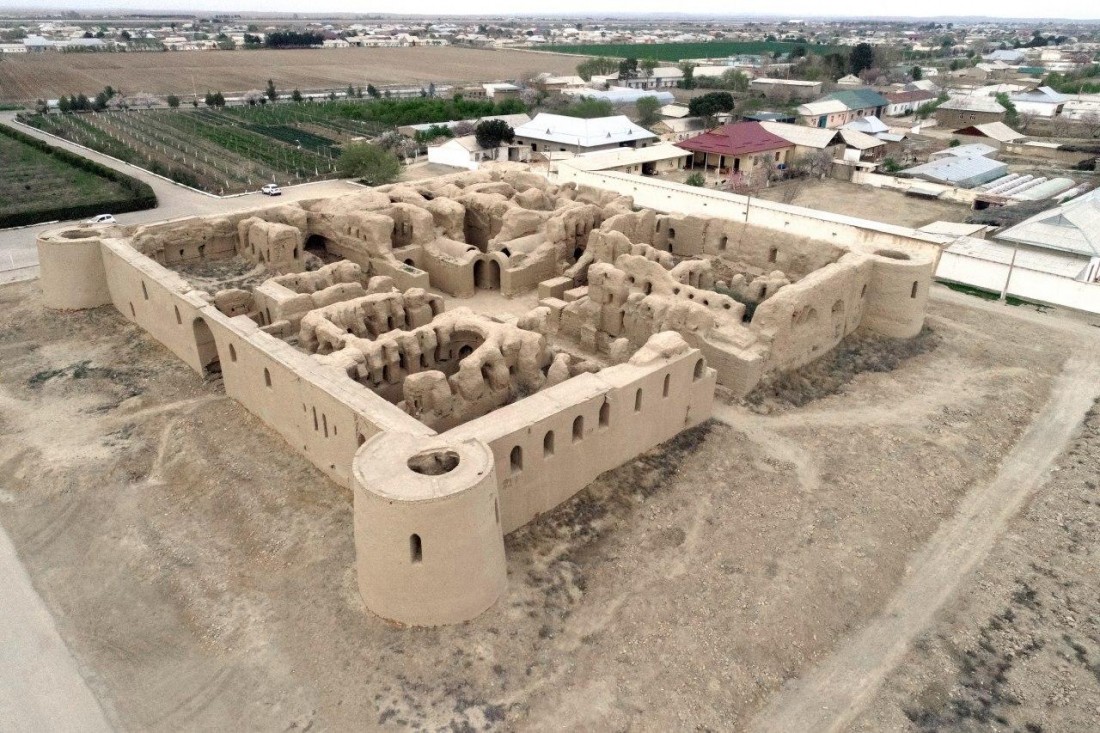
On the coast of the Amu Darya, 30 km from Termez, there are the ruins of the ancient city of Kampyrtepa.
In 2018, scientists proved that it was here that the residence of Alexander the Great, ancient Alexandria on the Oksa, the other name of the Amu Darya, was once located. This was evidenced by the discovery of new objects and cultural layers related to the period when the great commander came here. The Kapmyrtepa settlement is a citadel surrounded by a moat and an inner-city surrounded by a fortress wall with towers. The citadel of the ancient city was inhabited at the end of the 4th century BC. NS. And the inner city was built at the beginning of the 1st century AD and existed until the formation of the Kushan kingdom on this territory in the 2nd century AD.
On the territory of the ancient port city, scientists carried out unique works on the conservation of objects. Life in the city of Kampyrtepa lasted at least 500 years and is divided into three historical periods:
1. The initial stage – the arrival of Alexander the Great and the settlement of Kampyrtepa (IV-II centuries BC).
2. The Kushan-Yuezhi stage is the most stable and calm period (II – I centuries BC).
3. Kushan stage – the period of the highest flowering of Kampyrtepa (1st – 2nd centuries AD).
Now Kampyrtepa includes the “Lower City”, a deep moat, and a citadel. The “Lower City” is protected by a powerful fortress wall with rectangular towers. Inside the “Lower City,” there are various rooms, united into four large blocks and separated by corridors. The unfortified part of the city is mainly occupied by burial complexes. Also on the territory, you can see the remains of a Buddhist temple, examples of folk art, architectural and design solutions from various historical periods, which is of great interest for scientists and history lovers.
Artifacts such as coins, fragments of Greek writing, household items and tools, various equipment, containers for storing grain, jewelry made of silver, bronze, and other materials were found on the territory of Kampyrtep.
Now the Kampyrtepa fortress is included in the UNESCO List of Cultural Heritage Sites.
The ancient fortress city of Ayritam is located 18 km east of Termez. From the beginning of our era, with the penetration of Buddhism into the territory of Central Asia, the construction of Buddhist religious monuments began here. In fact, Buddhist religious monuments were erected on the ruins of Greco-Bactrian buildings.
During the period of the Kushan kingdom, a large Buddhist temple and a monastic center were built here, which occupied an area of almost 3 km along the banks of the Amu Darya. In the second half of the 3rd century, Ayritam fell into decay and never recovered.
Under the leadership of Academician M. Masson, in 1932, fragments of a frieze depicting people were raised from the bottom of the Amu Darya. A year later, 7 more fragments of the frieze and the ruins of a Buddhist temple were discovered. The images date back to 1-2 centuries AD. These were images of musicians playing musical instruments, as well as young men and women with wreaths on their heads, holding trays of fruit in their hands. The friezes of Ayritam reflect the scene of farewell to Buddha. According to legends, the sounds of five musical instruments should accompany the deceased Buddha with pleasant melodies, and dominants should accompany him on his last journey with fragrant flowers.
Moreover, thanks to this find, a close connection was discovered between the frieze of Airitam and the ancient Gandhara school of arts. Thus, the theory of the existence of the Gandhara school was confirmed as an invaluable historical and cultural reality directly related to the Kushan Empire.
In addition, two tombs were discovered at Ayritam, dating from the late 2nd century BC and the 4th century AD, in one of which a warrior with a weapon was buried, and in the other, a skeleton of a woman buried with dishes and ornaments was found.
In 1964, a stupa covered with stone blocks was dug 1 km east of the Ayritam temple.
In 1979, archaeologists discovered a very interesting monument next to a Buddhist temple. It showed two figures found in the description in the Bactrian sources, with six lines engraved below them.
Khalchayan is an architectural site that represents the most ancient ruins, including those of Khanakokhtepa, Karabogtepa, Maslakhattepa, and others.
Here were found the remains of a canal, a palace, various buildings, as well as traces of garden plantings.
The palace in Honokokhtepa had a wooden iwan, a living room, a throne room, and various other rooms connected by corridors.
The foundation of the palace was stone, and its well-built walls were made of raw bricks 1.40-2.30 meters high. On the walls of the palace, there are traces of whitewash, as well as patterns and drawings.
For example, a fragment of an image was found, which captured a young Bactrian youth with smoothly slicked hair back, next to him was another youth, apparently belonging to a different ethnic group.
The buildings of the complex are decorated with sculptures painted with glue mixed with natural dyes. Masterfully executed images of men and women, for example, warriors and a ruler talking to someone, as well as scenes of battles.
Numerous archaeological finds have been discovered in Kholchayan, such as hum, that is, a large jug for storing food, a jug, a basin, ceramic dishes, as well as a saber, dagger, jewelry, and gold coins.
This place in 1959-1963 was studied by the art history and archaeological expedition of the Institute of Art Criticism under the auspices of the Russian Federation under the leadership of G. Pugachenkova.
Remains of the ruler’s palace dating from the 2nd – 1st centuries. BC, found in Honakokhtepa by G. Pugachenkova, belonged to the leader of one of the Yuezhi tribes, Geray. Life on the territory of this architectural place continued until the beginning of the 3rd century A.D., as evidenced by the coins of Vasudev I.
For a long time, the Surkhandarya region remained a mystery. Until the last quarter of the 19th century, the mountains located in the south of the Hissar ridge were practically unexplored. In 1875, during the “Hissar expedition”, the Surkhandarya region began to open from a new side.
It was found that the Surkhandarya oasis is located in a depression on the plain, and is bordered by mountain ranges from the east, north, and west.
In the south, the oasis is washed by the most abundant river in Central Asia – the Amu Darya. Geographic location and orographic features have shaped the unique climate of this area. The western spurs of the Hissar ridge protect the valley from the invasion of cold air masses, and the southern side is open for the penetration of warm tropical air.
The climate and geography of Surkhandarya made it possible to preserve historical monuments, such as the ruins of ancient cities, untouched natural attractions, almost in their original form.
Surkhandarya has become an interesting tourist route, within which you can see architecture that is atypical for Uzbekistan, colorful old buildings, as well as get acquainted with the unique, distinctive culture that is characteristic of this region.
It is known that Alexander the Great, Genghis Khan, Ibn Battuta, Rui Gonzalez de Clavijo passed through Surkhandarya. Since ancient times, Surkhandarya has linked the ancient cities of Sogdiana with Bactria and India. This place has always attracted travelers, explorers, and adventure lovers.
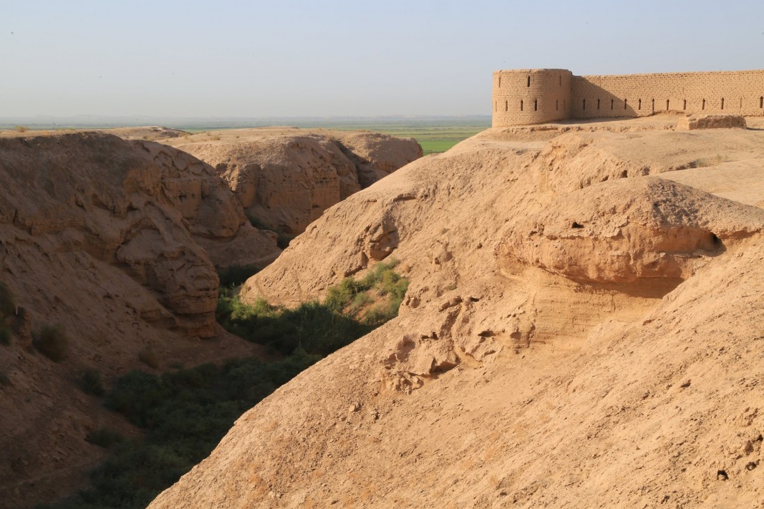
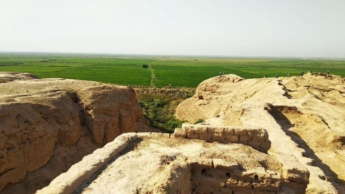
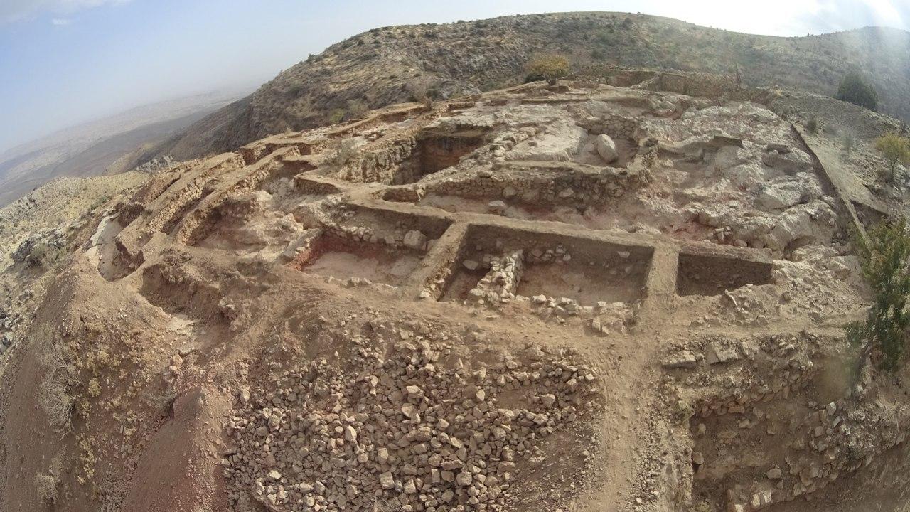
Uzundara is the oldest fortress of the 3rd-4th centuries BC, the ruins of which were discovered on the territory of the Surkhandarya region (near Derbent) by a joint expedition of the Institute of Archeology of the Russian Academy of Sciences and the Institute of Art Studies of the Academy of Sciences of Uzbekistan.
The border fortress of Uzundara was the main strategic hub on the vast system of protection of the northern borders of the agricultural oases of ancient Bactria from the raids of nomads.
The stone fortress, located in the foothills of Boysun at an altitude of more than 1700 meters, had powerful fortifications in the form of double fortress walls, reinforced with 13 towers and parts of the outer walls with a length of up to 1 kilometer.
The fortress was located between the Uzundara gorges and the Kara-Kamar tract, thereby blocking the mountain pass into the valley.
Thanks to the quality of the materials used in the construction of the fortress, the walls made of stone and clay mortar, after more than 2000 years, have almost retained their original appearance and to this day they rise to a height of 5 meters.
The mountain fortress has two basements, the bottoms of which were originally sheathed with lead plates.
Outside the fortress, there was a trading square, where local residents brought goods for the soldiers of the garrison.
As a result of archaeological research, scientists were able to determine the location of the northern borders of the Bactrian state. Among the main finds discovered during the expedition are unique coins of the Hellenistic period with the image of Alexander the Great, Antiochus I, and all the rulers of the Greco-Bactrian kingdom from Diodotus to Heliocles.
Also, scientists discovered a large number of arrowheads and darts, which confirms the fact of the passage of major battles, in particular on the eastern side of the fortress, and clearly illustrates the possibility of breaking through the fortress.
The fortress existed for about 150 years and perished during the reign of one of the last Greco-Bactrian kings in 171-166 BC as a result of the invasion of the hordes of the nomadic tribes of the Saka and Yuezhi.
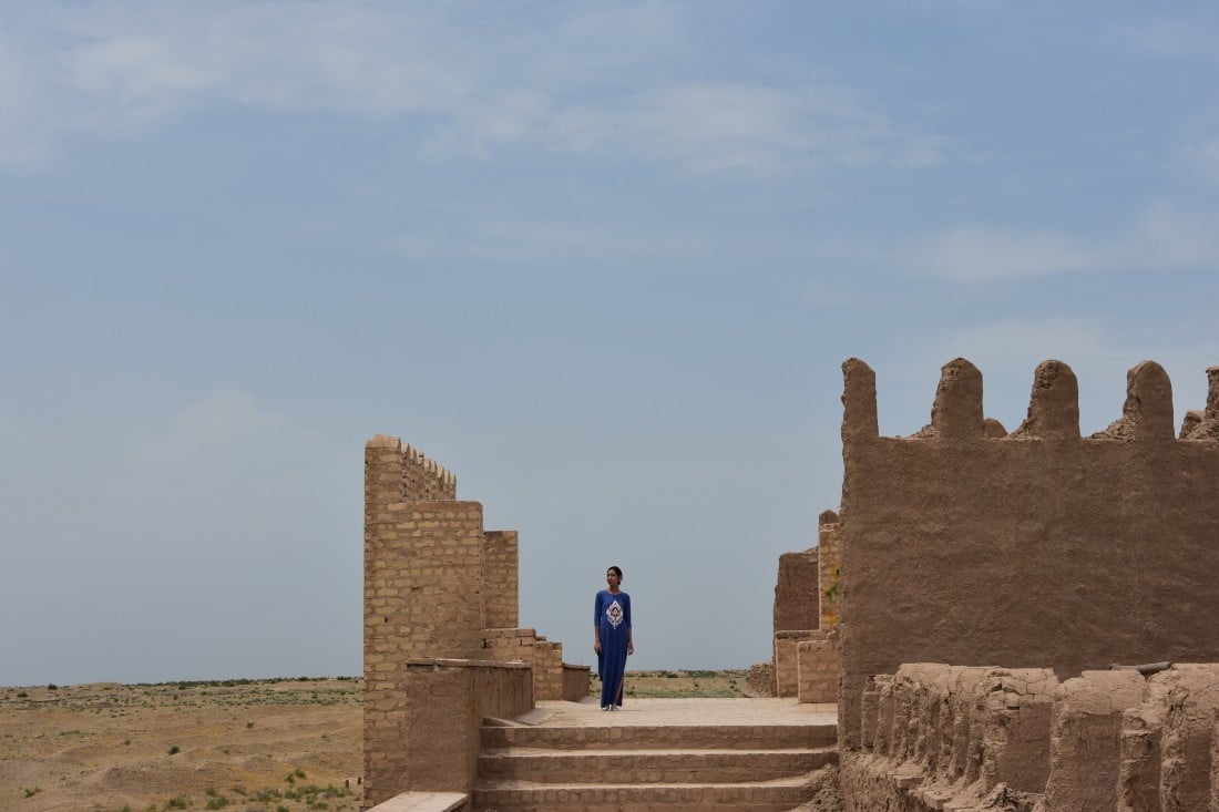
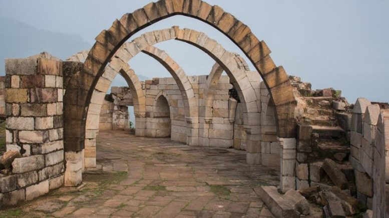
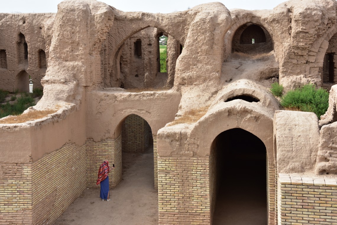
The ancient Kirk Kiz fortress, which name means “Forty Girls”, is located 3 kilometers west of old Termez. This architectural monument has been preserved in the form of ruins in the Termez region.
Archaeologists have indicated the approximate date of the construction of the fortress, as the 9-10th century, but up to the 14th century, the fortress was rebuilt several times.
Its location outside the city of Termez in the Middle Ages shows that it was a citadel.
All rooms in the center of the fortress are connected by corridors. The central part is considered to be a courtyard or vaulted hall. The courtyard and corridors divided the building into 4 parts.
An ancient legend is connected with the Kirk Keyes fortress. The fearless princess Gulaim once lived in this fortress with her retinue of 40 fearless Amazons. This is where the name of the ancient fortress comes from. Fearless Amazons, defending their fortress and mistress, repelled the attacks of enemies and did not allow men to approach them.
But one day a young man named Kokildor-Ota was able to penetrate the fortress. He grew long braids for himself and thanks to them he was able to get into the fortress. The young man’s cunning plan was revealed, the princess fell in love with him and they played a magnificent wedding.
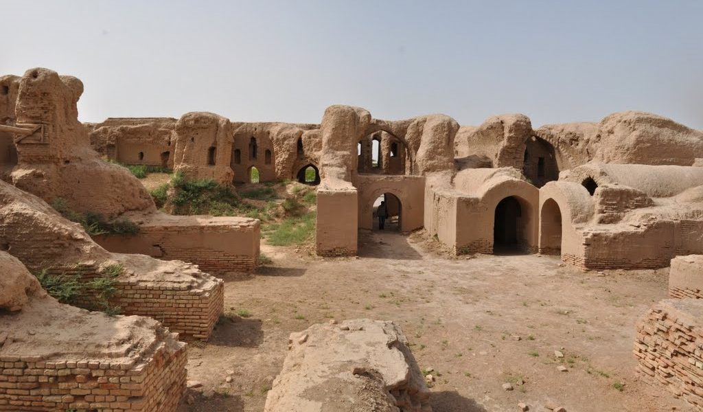
This is probably why the ruins of the Kirk Keys fortress resemble an impregnable castle, although, in fact, the building has always had a clear layout: a large palace with a huge number of rooms with wide corridors.
If you visit the ancient fortress, you will be able to see the remains of an unusual room that once served as a local chillahona. There to this day, there is an old tree, the branches of which are tied with small kerchiefs. According to legend, childless women come here who want to know the happiness of motherhood. With a prayer for offspring, they tie small ribbons here with the names of future children.
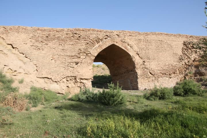
The ancient bridge, which was built in the 16th century, is located on the site of an ancient trade road that connected the southern regions of the Hissar mountains with Old Termez. Now the bridge is located near the M 41 highway on the territory of the Kumkurgan district. Locals call it “Gisht-Kupryuk bridge” or “Iskander Zulkarnayn bridge” (Alexander’s bridge). Local legend says that this place was crossed by Alexander the Great with his army. Initially, the bridge served as an aqueduct, and a stream 20 meters wide and 10 meters deep passed under it.