
Intersection of Science and Policy
Extremely Dangerous Storm On Our Doorstep
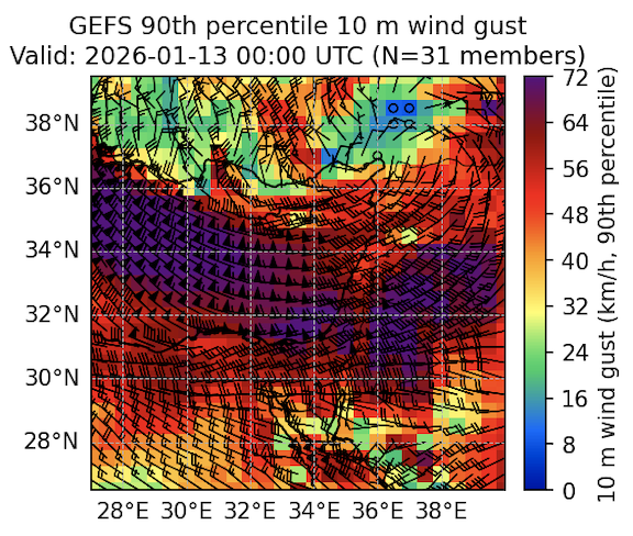
Strongest Forecast Wind Gusts (Barry Lynn/NCEP GEFS)
A storm moving southeastward toward Cyprus is expected to intensify as cold air streams southward from far eastern Europe and western Russia. Winds will be stronger than the last, damaging storm.
This system will bring both strong winds and heavy precipitation. Winds will strengthen Tuesday morning, with gusts exceeding 75 km/h from late Tuesday afternoon through Wednesday. Precipitation will begin Tuesday afternoon and is expected to become extremely heavy Wednesday night, increasing the risk of flooding in many locations. Thunderstorms may produce hail.
Temperatures will drop to the coldest levels of the season, with snow expected on the Golan Heights. In the northern and central mountains, roads may become slick during periods of intense precipitation.
Moderate precipitation is likely to continue through Wednesday, and the colder conditions are expected to persist throughout the week.
Barry Lynn
Related Topics
Related Posts