From Kibbutz to the global stage
Judean Desert: Unknown Ancient Water System Near the Biblical Village – Sekhakha?
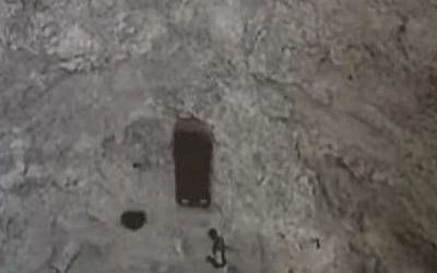
The Nahal Sekhakha Tunnels: An Ancient Water Engineering Project in the Judean Desert?
In 1958, Professor Yigael Yadin—the renowned archaeologist and Israel’s second Chief of Staff—wrote in his article on water supply in times of peace and siege:
“There are regions where water arrives only in the form of sudden flash floods that quickly pass, leaving behind a thirsty land. Such is the Negev. Following torrential rains in the mountains, powerful streams rush through the wadis and disappear almost as quickly as they appear. Humanity’s task is to gain control over these water sources—groundwater and rainwater—in order to organize their distribution across extensive areas.”
A few months ago, I visited Nahal Sekhakha in the Hurqania Valley of the Judean Desert. There I encountered two remarkable tunnels cut diagonally into the mountain, extending in opposite directions. My immediate thought was that they might somehow be connected to water.
Perhaps that idea was influenced by my own background. During Israel’s waiting period before the Six-Day War in May 1967, the adults in my kibbutz were called up for military reserve duty. Those of us about to graduate from high school replaced them in essential civilian roles, and I became responsible for the kibbutz’s irrigation and water systems. Since then, I have maintained a lifelong interest in water management, irrigation, and water resources.
Nearly two decades have passed since the archaeological excavations at Nahal Sekhakha ended in 2007, yet no consensus has emerged regarding the purpose of these extraordinary tunnels. The mystery remains unresolved.
The following article does not claim to present a proven archaeological conclusion. Rather, it proposes a hypothesis that developed after visiting the site, reviewing the archaeological literature, and drawing upon decades of practical experience in water management. Its purpose is not to determine the tunnels’ original function, but to suggest a new research direction that could eventually be examined through archaeology, geology, hydrology, engineering simulations, and field experiments.
A Mystery That Has Endured for Decades
The history of the site is almost as fascinating as the tunnels themselves. Unauthorized excavations began as early as the 1950s. Later, Bob Morgan, an American Vietnam War veteran and pilot, became convinced that treasures described in the famous Copper Scroll, discovered near Qumran and popularized by British archaeologist John Allegro, were hidden inside these tunnels.
Beginning in 1986, Morgan spent nearly twenty years excavating the site, initially with only a handful of companions. He hid from Israeli military tanks conducting exercises in the area, confronted Bedouin looters, and gradually became something of a real-life Indiana Jones of the Judean Desert.
In 1999, archaeologists from the Hebrew University of Jerusalem joined the excavations. Yet even after the official project concluded in 2007, no definitive explanation emerged for the tunnels’ purpose. What is known is that two tunnels were carved into the mountainside at the point where the narrow canyon of Nahal Sekhakha opens toward the Hurqania Valley.
The northern tunnel extends approximately 60 meters, descending westward at a steep angle of about 60 degrees to a depth of roughly 50–53 meters.
The southern tunnel descends eastward at a gentler angle of about 30 degrees. It extends approximately 100 meters before splitting into two short branches, giving it a total length of nearly 120 meters while reaching approximately the same depth as the northern tunnel.
The entrance to the northern tunnel lies about one meter above the wadi floor, whereas the southern entrance is located roughly two meters above the wadi floor.
Existing Explanations
Over the years, several theories have been proposed regarding the tunnels’ purpose. Some researchers suggested they served as a sanctuary dedicated to the sun god, similar to a tunnel discovered in Turkey. Others proposed that they were exploratory mining tunnels or the result of forced labor carried out by prisoners, slaves, or rebels.
None of these explanations fully convinced me.
A ritual tunnel, for example, seems difficult to reconcile with a 60-degree incline that makes movement extremely difficult, particularly given the limited oxygen deep inside the mountain.
The forced-labor hypothesis raises similar questions. If prisoners had spent extended periods working underground, one might expect to find refuse, traces of habitation, or inscriptions on the walls. None have been reported.
The mining hypothesis also appears problematic. Mining operations generally follow geological ore veins rather than terminating in steep, narrow tunnels, especially one that ends in a fork pointing in essentially the same direction. Moreover, it is difficult to understand why such tunnels would have been excavated in a flood-prone wadi instead of on the much drier eastern slopes of nearby Hyrcania Fortress, where working conditions would have been considerably easier.
Hyrcania Fortress itself was constructed by John Hyrcanus of the Hasmonean dynasty atop the hill overlooking the tunnels. Yet several centuries earlier, during the biblical period, many scholars believe that the settlement of Sekhakha stood approximately two kilometers away at the site now known as Khirbet Karm es-Samra. Archaeological evidence has not yet established precisely when the tunnels were excavated. Although the prevailing view attributes them to the Hasmonean period, they may in fact be considerably older.
A Different Possibility
While reviewing the available archaeological evidence, another possibility occurred to me—one I did not find explicitly discussed in the literature I examined.
Perhaps the tunnels, or at least part of them, were components of an ancient system designed to manage flash floods by directing water underground and artificially recharging local groundwater reserves.
This is, of course, only a hypothesis. It requires careful examination, particularly because intentional groundwater recharge is not currently recognized as part of the known water systems of either the Kingdom of Judah or the Hasmonean period.
The possibility that these tunnels were connected to water management led me to reconsider one of the earliest large-scale water programs described in the Bible.
The water projects associated with Kings Uzziah and Hezekiah sought to improve water supply and strengthen Judah’s ability to withstand siege. While Hezekiah’s famous Siloam Tunnel remains one of the best-known hydraulic engineering achievements in ancient Israel, Uzziah’s activities are described primarily in the context of agriculture and settlement.
Second Chronicles (26:10) states:
“He built towers in the wilderness and dug many cisterns… He also had farmers and vinedressers… for he loved the soil.”
This verse may point to three important components of Uzziah’s policy:
The construction of fortified agricultural outposts throughout the wilderness. The development of an extensive system of water storage installations. Active agriculture in arid frontier regions.
Some scholars identify the nearby site of Khirbet Karm es-Samra with the biblical settlement of Sekhakha, suggesting that the area’s agricultural history may stretch back to biblical times.
Additional support for considering a water-related interpretation came from a 2019 field survey led by the late Ze’ev (“Ze’abo”) Erlich, one of Israel’s leading researchers of the Land of Israel.
According to the published survey, the northern tunnel descends at an angle of approximately 60 degrees for about 60 meters until reaching groundwater. The southern tunnel extends approximately 100 meters at a gentler angle before splitting into two short branches that appear, at first glance, to lead nowhere.
The researchers also noted several intriguing observations. Lamp niches were carved into the tunnel walls, yet no traces of soot were found. The steps were significantly more worn in the deeper sections of the tunnel than near the entrance, and climbing back to the surface proved far more exhausting than descending.
None of these observations demonstrates that the tunnels formed part of a hydraulic system. Nevertheless, when considered together with Yigael Yadin’s discussion of floodwater management in the desert, the site’s topography, climate, and known archaeological evidence, they suggest another possibility: that the tunnels may have been designed to channel flash-flood water underground in order to recharge groundwater within a defined area.
A Possible Hydrological Model
From this point onward, what follows is entirely theoretical.
The model is based on the tunnels’ geometry, orientation, location, surrounding topography, and basic hydrological principles. Should archaeologists and hydrologists consider the hypothesis worthy of investigation, it could eventually be tested through geological studies, hydrological modeling, engineering simulations, and controlled field experiments.
The Northern Tunnel – A Rapid Collector
The northern tunnel may have served as the first stage of the system.
Its entrance lies relatively low within the wadi, while its steep 60-degree inclination could have enabled flash-flood water to enter rapidly during peak flow.
In hydrological terms, this geometry may have created a significant hydraulic head, allowing large volumes of water to penetrate quickly into the mountain.
The pronounced wear observed on the lower steps may therefore reflect not only centuries of human movement but also prolonged water flow—although this possibility likewise requires verification.
The Southern Tunnel – Controlled Infiltration
The southern tunnel may have fulfilled a complementary function.
It is longer, less steep, and divides into two branches near its end.
Rather than maximizing rapid flow, such a configuration could have slowed the water, increasing the contact area between water and rock and promoting gradual infiltration into the subsurface.
Modern groundwater recharge systems frequently seek precisely this effect by maximizing the surface through which water infiltrates permeable formations.
Its eastward orientation may also have been intentional if groundwater recharge was aimed toward wells and agricultural areas located farther down the Hurqania Valley.
Did the Two Tunnels Function Together?
Another possibility is that the two tunnels interacted hydraulically through the same fractured rock layer.
If both connected—directly or indirectly—to a common permeable geological formation, water entering rapidly through the northern tunnel might have generated hydrostatic pressure that enhanced movement through the southern tunnel.
Under this interpretation, the entire system could be viewed as a single hydraulic installation.
The northern tunnel would rapidly capture floodwater and direct it underground.
The southern tunnel would slow the flow, distribute the water through its branches, and encourage gradual infiltration into the surrounding rock.
Although entirely theoretical, this model could explain why two tunnels with very different geometries were constructed at the same site, reaching almost identical depths while differing markedly in length, inclination, and internal layout.
Testing the Hypothesis
If this hypothesis merits investigation, modern science offers several ways to evaluate it.
Computer-based hydrological simulations could model the movement of flash-flood water through the tunnels under various flow conditions.
Geological investigations could determine whether the tunnels intersect permeable rock formations connected to the wells farther down the valley. Rock permeability measurements and tracer experiments could provide valuable information regarding underground water movement.
The site could also serve as an excellent case study for experimental archaeology. Carefully controlled water releases—or simulations of flash floods—combined with pressure sensors, moisture monitoring, conductivity measurements, and groundwater observations could help determine whether the tunnels maintain a hydrological connection with the surrounding aquifer.
If such experiments demonstrate controlled groundwater recharge, the hypothesis would gain considerable support. If not, researchers could confidently reject it and continue searching for another explanation.
Ancient Parallels
Even if the hypothesis ultimately proves incorrect, it is worthwhile comparing it with ancient water-management systems elsewhere.
Across the Middle East—particularly in Iran, Jordan, and North Africa—archaeologists have documented underground water galleries and systems resembling principles now known as Managed Aquifer Recharge (MAR).
This comparison does not imply that the Nahal Sekhakha tunnels were identical to those systems. Rather, it demonstrates that ancient civilizations were capable of developing sophisticated methods for collecting, transporting, and storing water underground.
If the proposed interpretation is eventually confirmed, the tunnels may represent a unique Judean Desert adaptation of similar hydraulic concepts.
A Preliminary Hydrological Estimate
The following calculations are illustrative only and are based on reasonable assumptions rather than field measurements.
If the system infiltrated approximately 8,000 cubic meters of floodwater during a season—roughly four flood events of 2,000 cubic meters each—the added recharge would be equivalent to about 8 millimeters of rainfall across an area of approximately 100 hectares.
In a region receiving only 50–100 millimeters of annual rainfall, such an addition could have been highly significant.
Assuming that roughly one-quarter of the infiltrated water eventually reached nearby wells—approximately 2,000 cubic meters—and assuming a daily water requirement of about 10 liters per person in antiquity, this volume could theoretically have supplied around 1,000 people for nearly 200 days.
Although purely illustrative, the calculation demonstrates the potential importance such a system might have had during droughts or sieges.
Beyond the total water volume, the principal advantage of such a design would have been reducing evaporation losses by storing water underground—a critical consideration in desert environments.
A Successful Water Project—or an Unfinished Experiment?
One possibility is that the system functioned successfully for many years, supplying wells and nearby agricultural settlements. If so, it may represent one of the most remarkable ancient hydraulic engineering projects ever constructed in the Judean Desert.
Another possibility is that it was an ambitious engineering experiment that never achieved its intended results. Water movement through the rock may have proved slower—or faster—than expected, or historical events such as political upheaval, war, or abandonment of the region may simply have brought the project to an end.
Either possibility would remain archaeologically significant, reflecting ancient efforts to solve one of the greatest challenges of desert life: securing a reliable long-term water supply.
Conclusion
The tunnels of Nahal Sekhakha continue to raise fundamental questions nearly two decades after archaeological excavations ended.
This article does not claim to solve their mystery. Instead, it proposes an additional hypothesis based on archaeological evidence, historical sources, topography, hydrology, and practical experience in water management.
If future research supports this interpretation, the tunnels could represent one of the earliest and most sophisticated water-engineering projects in the Judean Desert—perhaps even an ancient precursor to concepts resembling modern flash-flood management and managed aquifer recharge.
If the hypothesis is disproved, that result would be equally valuable. Testing new ideas is an essential part of scientific progress, and examining this possibility may ultimately bring us one step closer to understanding one of the Judean Desert’s most intriguing archaeological mysteries.
Related Topics
Related Posts