
Intersection of Science and Policy
Severe Storms On The Way
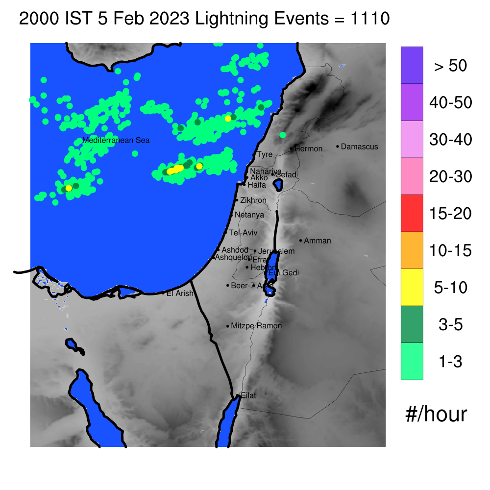
Israel Total LIghtning Network (part of ENTLN) from Sunday Evening
Dangerous Gale Force winds are again expected Monday afternoon into Monday night.
A rather strong winter storm approaching from the northwest will approach our area Sunday night and linger into late Wednesday. The result will be very heavy rains and snow at the highest elevations of the Galilee and Hermon.
Extremely cold air is originating all the way from Siberia, and it should continue to circulate into the storm as it persists into Wednesday. Thunderstorms developing in this cold air over the sea could bring flooding rains and hail.
So, why not snow in Jerusalem? It looks like the position of the upper level cold is just a bit too far north and west of our little state to bring the upper level cold needed for an accumulating snow. However, the cold in the lower and middle levels could lead to a wet snow or rain and snow mix as Tuesday turns into Wednesday.
Overall, the storm has moved a bit further south than previously forecast, but we’ll have to see an even bigger change to change our forecast for Jerusalem from rain to snow.
The chilly weather should persist into the end of the week, and possibly return again next week as well.
Related Topics
Related Posts